

We offer a comprehensive range of Geo - Spatial Services that deliver tangible business advantages to our clients. Our expertise in latest market technology such ESRI, AutoCAD, Micro Station and MAPINFO, helps meet the challenging needs of the customers. VH Info Solutions delivery model includes on-shore as well as off-shore capabilities. Our success is attributed to our skilled personnel, proven QA/QC systems, unparalleled client communication and attractive pricing. Clients are serviced through effective implementation and application of robust communication media, data services, professional services, maintenance and support.
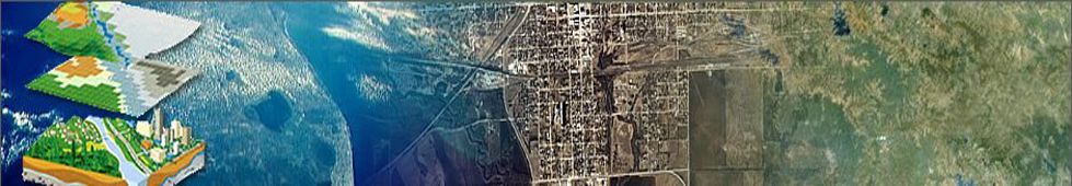
VH Info Solutions offers full spectrum of GIS services ranging from geospatial data creation, integration, analysis to visual simulation and application development. We have distinguished capability in the domains of Photogrammetry, Orthophoto production, rectification, LiDAR, 3 D City modeling, Remote Sensing, Mapping and Cartography.
GIS Data/Analysis Services
Through GIS data conversion, migration, maintenance and mapping services, VH Info Solutions provides multiple industries and governments with accurate, high-quality geospatial data to improve the way they conduct business. Our team has expertise in:
• Data Conversion, Data Conflation and Data Migration
• Change Detection Mapping
• Parcel Mapping/Cadastral Mapping/Golf Course Mapping
• Data Maintenance
• Scanning of Paper Maps
• Data Conversion/Digitization
• Contour Mapping
• Parcel/Property Mapping
• Data Cleaning
• Data Migration and Maintenance
• Data Updates
• Data Crunching
• Data Re-alignment
• 3D Terrain Models
• 3D Mapping
• Attribute Database Generation
• Upgrading Data to GIS Formats
• Mass Data Entry
We provide conversion services to Utilities, Telephone, Water/Wastewater and Government. The team works with most of the major platforms in the industry.
Geocoding Services
VH Info Solutions provides custom geocoding services as per customer specifications and requirements using a set tools ranging from batch geocoding (proprietary geocoding software) to manual intervention geocoding.
Our Team has expertise in:
• Address standardization
• Address categorization
• Appending PINdex +4
CADD Services
• Electrical & Plumbing Plans
• Interior Design Plans
• 3D Building Plans
• 2D and 3D Machine Drawings
• Architectural walk-through with realistically dimensioned objects
GIS Application Development
VH Info Solutions undertakes simple customization in leading GIS platforms for various purposes to development of large Enterprise-Level applications featuring design of High-Availability GIS Servers including design of large databases in leading platforms like Oracle.
• Design and Development of Enterprise-Level, High-Availability GIS Applications• Design and Development of Large Scale Web-GIS and Desktop Applications
• Customization in all Leading GIS Platforms
• Application Re-platforming and Migration
Data conversion & Data creation
VH Info Solutions provides a complete range of data conversion services - starting with customized individual services that allow clients the flexibility of selecting specific tasks to end-to- end project management. Leveraging its rich experience in this field of converting customers existing & legacy data, VH Info Solutions can deliver output data in any CAD and GIS format including ArcInfo, DGN, DWG, DXF, SHP and/or clients domain format.
GIS Implementation
Implementation of GIS in any organization requires critical planning, management, training and solutions to ensure success of geospatial program now and for years to come. VH Info Solutions expertise in GIS implementation includes, but is not limited to:
• Workflow Analysis• Project Management
• Integration
• Training
• Plotting Solutions
• Technical Support
Aerial Imagery Acquisition - Planning & Collection
VH Info Solutions provides Aerial photography services of all scales through our network of associate flying partnersAerial Triangulation & Adjustment
Aerial triangulation being the most important task in the Photogrammetry process, we pursue it with high precision. Our aerial triangulation team can perform bridging and block adjustment on photographs acquired from various aerial cameras at various scales.
We perform stereo compilation using both softcopy plotters and analytical plotters. Softcopy compilation affords the extra capability of superimposition which allows the stereo operators to see digitized map data optically superimposed on photogrammetric models. This greatly reduces map compilation time and enhances overall map accuracy. Stereo-compilation is performed for planimetric, DTM projects and also in updating old maps using new aerial imagery.
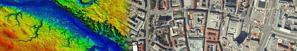
Digital terrain models (DTM) and digital elevation models (DEM) are used in visualizing the terrain changes generally termed as Terrain Analysis. These datasets are used to generate Digital Orthophoto (DOP) and are useful in Contour generation. Our resources possess high level of expertise in generating both automatic and semi-automatic DEM's.
We have the expertise for generating 3D buildings and urban models from stereo aerial and satellite imagery, or imagery and LiDAR data.
To remove the sensor and terrain related distortions from raw aerial imagery, orthorectification is used. Random errors of spatial data are usually adjusted by employing a fine distribution of ground control points (GCPs) through the traditional orthophoto generation and orthophoto mapping process.
We undertake Orthorectification with constant elevation sources in various formats including IMAGINE Raster, TIN, SOCET SET TIN, 3D Shapefile, and ASCII text files.
Further, VH Info Solutions has made significant investments in a state of the art in house technology infrastructure that can cut down the processing time drastically, to ensure timely and quality deliveries.
![]() Ortho-mosaicing
Ortho-mosaicing
![]() Color Balancing
Color Balancing
![]() Seamline editing and
Seamline editing and
![]() Tile cutting
Tile cutting
Remote Sensing and GIS techniques aid greatly in natural resources management and sustainable exploitation of natural resources. VH Info Solutions has worked with many commercially available satellite data products including IKONOS, QuickBird, SPOT, ASTER, IRS and Landsat, has extensive expertise in satellite image interpretation and processing.
Some of the applicatons of Remote Sensing are- Landuse/Landcover mapping using satellite data
Vegetation mapping with emphasis on bio-diversity, biomass, species diversity, crown cover density etc
Drainage Pattern of the area
Soil mapping
Slope Analysis using Digital Elevation Model (DEM), Digital Terrain Model (DTM) etc.
Watershed Prioritization for treatment purposes
Catchment Area Treatment
Habitat Assessment/Evaluation for wildlife etc.
Corridor mapping
Landslide zonation and mapping of vulnerable areas.
Socio-economic parameters in watershed management
Sustainable hydro-power development
Rainfall- Runoff modeling
Flood plain mapping
Wetlands Management
Eco-system Assessment
Disaster Management
EIA
Coastal Zone Mapping
Sea level Rise impact
Ground Water estimation
Site Selection for solid waste management
Land use/land cover/clutter (wireless) data mapping
High-resolution urban mapping
Crop classification from High and Low resolution imagery
Forest density mapping and species level forest mapping
VH Info Solutions has a full capability LiDAR Processing facility. We have performed several thousand sq kms of LiDAR data processing projects in different geographies of the world, primarily, Australasia, North America and Europe. Our processed LiDAR data can support generation of highly accurate digital elevation models (DEMs) for the bare earth as well feature extraction and analysis of vegetation, hydrology, electrical transmission lines, pipelines, 3D buildings, roads, and other infrastructure.
Classification of Bare Earth and Above Ground Features.
VH Info Solutions has performed classification of Bare Earth and Above Ground Features such as low vegetation, high vegetation, buildings and bridges. We have performed several powerline classification projects requiring the capture of features such as the powerlines themselves for sag analysis and the associated features like, pylons, poles, substations etc.
Bare Earth Classification supplemented by Breaklines
The LiDAR data can be enhanced for the generation of accurate contours by using breaklines. These can be further digitized. Breaklines are necessary to create dataset which are hydrologically correct
or to fill any other gross errors in the LiDAR data.
Feature Extraction from Terrestrial LiDAR Data
We have experience in classifying and extracting features from terrestrial LiDAR data, as well as modelling them in the level of detail required by our clients.
Please Note: Project Samples can be provided on demand
3D City Modeling integrates geo-referenced imagery with GIS data into a virtual environment. By providing an accurate, photo-realistic 3D model of any location, City Models are a very powerful tool for city planning, tourism, real estate, and security.
It is a highly efficient and productive tool for spatial planning projects. It provides planners with futuristic, visually comprehensible scenario.
The 3D city models are created on the basis of existing orthophotos and height models and can be used for 3D visualization of a new structure or infrastructure projects.
We provide an extensive array of GIS and mapping services to assist organisations from various industries in their learning, planning, management, assessment and communications activities.
We offer services in the field of Cartography. We have vast expertise in offering cost-effective, technology-driven cartographic services.
We provide value-added design support solutions evolving from Building Information Modeling (BIM), Computer aided design (CAD) documentation and 3D modeling services to AEC firms (Architecture, Engineering and Construction), globally.
VH Info solutions works with architects, Interior designers, Custom home builders and MEP Consultants to provide complete support services to cover space planning, design and construction documentation.
Our range of services is for projects from simple residences to large commercial buildings such as offices, retail outlets, hotels, hospitals and other public outlets. Our Team is well versed with American and European work standards of construction technology. Most of our Team members are affiliated with AIA (American Institute of Architecture), RIBA (Royal Institute of British Architects) which helps us in working on contraction documentation of any geographical region.
Utilizing the expertise of our technical team, our clients have benefited from our vast range of CAD/BIM services that has helped them to reduce their operational costs, save time and provide enhanced construction value by utilizing all the advantages of CAD/BIM Technology.
In this vertical we offer following bouquet of services:
CAD and BIM Documentation
BIM Clash Detection
Revit Family Creation
Digital Coordinated Documentation
2D 3D Animation
Modeling and Visualization
In the Engineering Services space, VH Info Solutions is providing solutions in Multidisciplinary Engineering fields. VH Info Solutions is one of the fastest growing Engineering Services Off-shoring vendors in India.
We provide following Engineering support services:
Land Development
With a track record of optimal turn-around time and top-notch quality, VH Info. Solutions offers following Land Development & related design assist services:
RESIDENTIAL LAND DEVELOPMENT SERVICES:
• Base file generation (lot plan)
• Tentative / preliminary plan
• Grading design
• Paving design
• Drainage area & hydrology studies
• Storm drain design
• Sewer design
• Plan & profile sheets
• Final plat
• Material takeoffs or cost estimates
• Plot plan
COMMERCIAL LAND DEVELOPMENT SERVICES:
• Rough grading
• Precise grading
• Preliminary drainage reports
• Storm water pollution prevention plans (SWPPP)
• Demolition & street widening plans
• Utility plan & profiles
• Storm drain plan & profiles
HYDRAULIC & HYDROLOGY STUDIES:
• Pond design
• Flood modeling
• Storm drain modeling
• Rainfall / runoff studies
• River/channel studies and modeling
• Storm water quality impact and use of Best Management Practices (BMPs)
• Wash grade works
• Urban flood modeling
• Public Works
• Lift station
• Road widening
• Pavement relocation
Architectural Engineering
VH Info Solutions offers combination of support services to cover all aspects of architecture, interior design, space planning of commercial and buildings such as offices, multiplexes, multistoried residential apartments. We also provide specialized services in the areas of feasibility studies, project planning and facility management in all aspects of design/ implementation process from conception, visualization, detailed design, estimation and valuation, project management.
Several of the support services offered at different stages of the project are:
- Design Development
- Presentation
- 2D presentation - Rendered floor plans, landscape drawings.
- 3D presentation - CAD modeling, Walk thru, perspectives and views.
- Working drawings
- Preparation of coordinated working drawings set from conceptual sketches for Architectural,
- Structural, Building services (MEP) Detailing of Interiors, Landscaping.
CAD Data Conversion
- Development of portfolio for facility management
- Architectural 2D/3D Drafting
- Paper to CAD Conversion
- Incorporation of CAD redlines - Generation of CAD outputs from preliminary design
- Design Calculations
- As Built Drawings & Survey
We aptly perform all other Architectural Engineering Support Services at different stages of project such as Structural Design, Electrical and Service Layouts, MEP Engineering, HVAC, Transportation, Land Development, Hydraulics, Project Estimation, Bill of Quantities and Survey.
Structural Engineering
VH Info Solutions provides associate and support services to the Structural engineering sectors. We have carried out numerous projects on commercial structures, industrial structures.
Our main areas of service in Structural Engineering include multi-story residential, commercial and service structures like schools, offices, parking silos, places of worship; support structures for industrial equipment and pipelines have been developed, while in Bridges they include small overpasses and underpasses. With construction solutions in concrete, steel and composite materials, we can aptly elucidate solutions based on American, Euro Codes, British and Spanish Codes. We are also experienced in timber structures solutions mainly for small residential buildings.
We command over detailed analysis and design of structures as per codes with elaborate design support followed by structural drawings and bar bending schedule/ fabrication drawings.
Structural Design of Residential/Commercial Structures
Bridge Design (RCC & Steel Bridges)
Industrial Structures & Machine Foundations (ISMF).
ISMFs require high precision and rigorous quality standards due to their scale.
We specialize in:
- Industrial Building Structures
- Machine & Equipment Foundations
- Crane Girder Design
- Silos and Ware-House Design
- Conveyor Support Structures
- Water Retaining Structures
- Underground Storage Tanks
- Overhead Water Storage Tank
Construction methodologies like Pre-cast/Pre-tensioning and Post-tensioning have been utilized for long span building structures and bridges, and in some foundation solutions.
MEP/HVAC
Design and drafting services for HVAC system construction plan drawings
- Demolition and existing plan drawings
- Duct sizing and design layout plan drawings
- Equipment piping sizing and design layout plan drawings
- Design development and construction plan drawings
- Details, schematics, schedules, legends and control diagrams
- Mechanical equipment layouts, submittals and elevation drawings
- As-builts, specifications, coordination drawings, shop drawings and addendums
Plumbing
- Drafting service for domestic water plumbing system construction plan drawings
- Compressed air and medical gas system plan drawings
- Demolition and existing plan drawings
- Legends and addendums
- As-builts, specifications, coordination and shop drawings
Mechanical Fabrication
- Precisely scaled and dimensioned mechanical component fabrication drawings
- Mechanical engineering and mechanical design drawings
- Mechanical equipment layouts and product installation drawings
- Casting, machining, welding and assembly drawings for the machine shop
- Mechanical schematics, sections and detailing
- Mechanical submittal packages, Shop drawings, Bill-of-materials
Architectural, Electrical and Fire Protection
- Architectural floor plans, house and wall sections, elevations and details
- Structural foundation, framing and roofing plans
- Electrical, power and lighting plans, site plans, one line diagram
- Electrical panel schedules, Fire protection and sprinkler plans
- Fire protection details, schematics and diagrams
Transportation Engineering
VH Info. Solutions has a proven track record in providing quality and cost-efficient engineering solutions in the field of Transportation, with specialization in highway and railroad design. We have consistently delivered projects on time, and to a high level of client satisfaction, in the above mentioned fields.
Our Highway design services include:
- Survey maps, strip plans, and existing surface profiles
- Digital terrain modeling
- Intersection design
- Drainage design
- Earthwork quantification
- Drafting and plan and profile sheet generation
- Toll Facilities design
We also provide the following services in Railway design:
- Commuter rail design
- Freight rail design
- Light rail design
- Heavy rail design
- Alignment, track, and right of way design